Tuscany 2020?

|
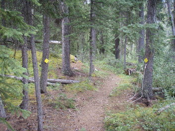
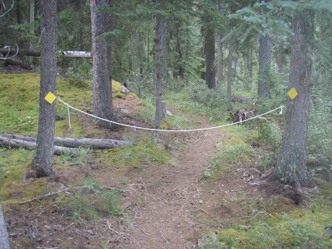
September 8 In the past I have had a bad habit of neglecting to keep a good trail record of my hikes and paddles but I made a real effort on this hike. The reward for my diligence is the opportunity to reproduce my notes here with interjections (which I'll show in green) where I feel it necessary and much less mental stress trying to remember what I saw and did. 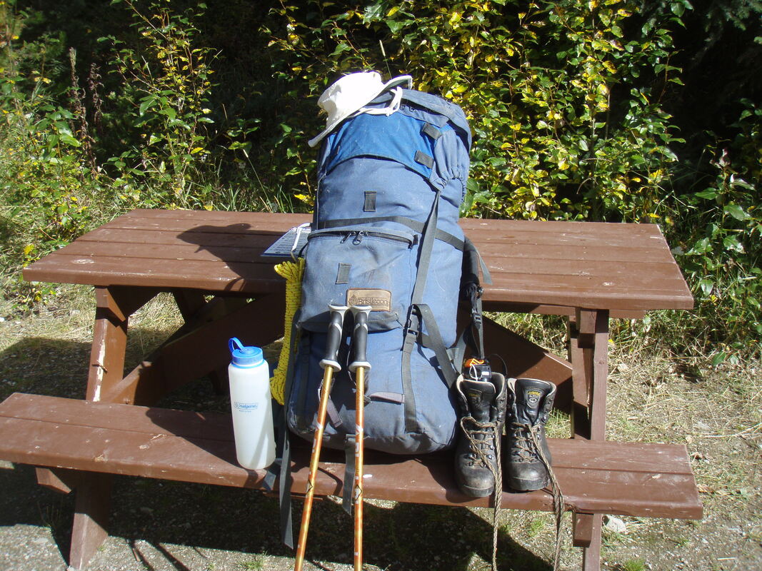 My 15kg pack and other equipment. I drove from Jasper to Moab Lake parking lot and started to walk from the parking lot at 11:45. After walking the first 800m I arrived at the trail that leads down to Moab Lake. 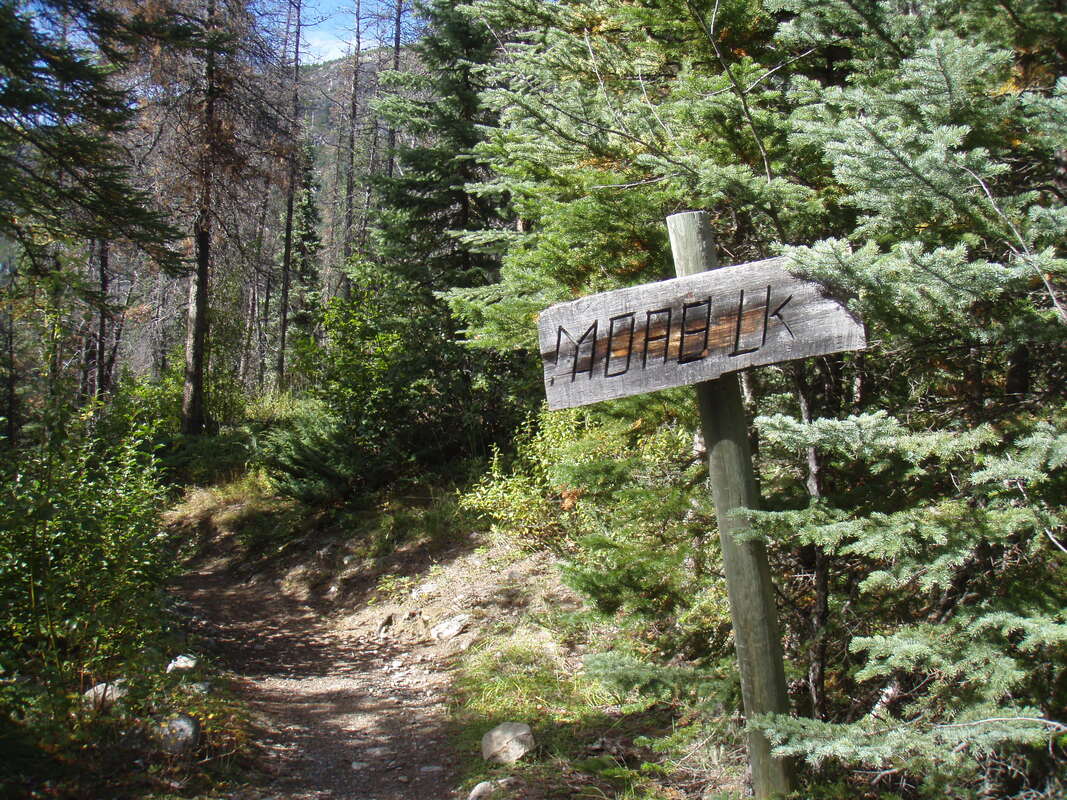 I decided to walk for an hour before stopping for a lunch break and at 12:43 I stopped at the same spot that I stopped at on my last hike to Whirlpool Campsite. It's a good spot because of the convenient fallen tree to sit on. I ate two granola bars then set off again and arrived at the campsite shortly after 14:00. While I was stopped for lunch a couple came by on mountain bikes and we greeted each other briefly and they continued on their way. Later, after I had set up my camp they came into the campsite and we had a very enjoyable chat. It turned out they had been in Jasper for four years. In my last post I talked about Whirlpool Campsite and my bivvy sack but I didn't include any pictures so I'll correct that omission now. 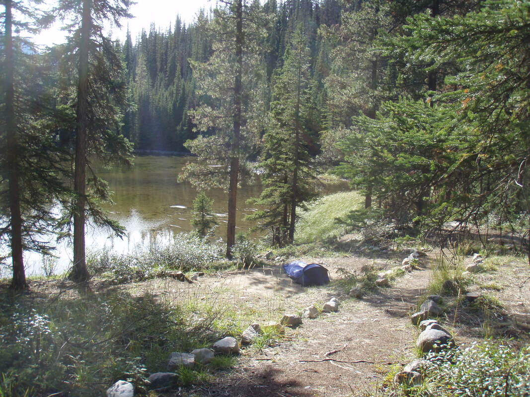 The tent pad, my bivvy sack and the lake. My bivvy sack is ideal for solo hikes because it is light and doesn't take up too much space in my pack. The next picture will give you a better idea of its size and how it is designed to keep the occupant comfortable and dry. I have a ThermoRest sleeping pad, a down sleeping bag and a self inflating pillow inside that keep me comfortable. 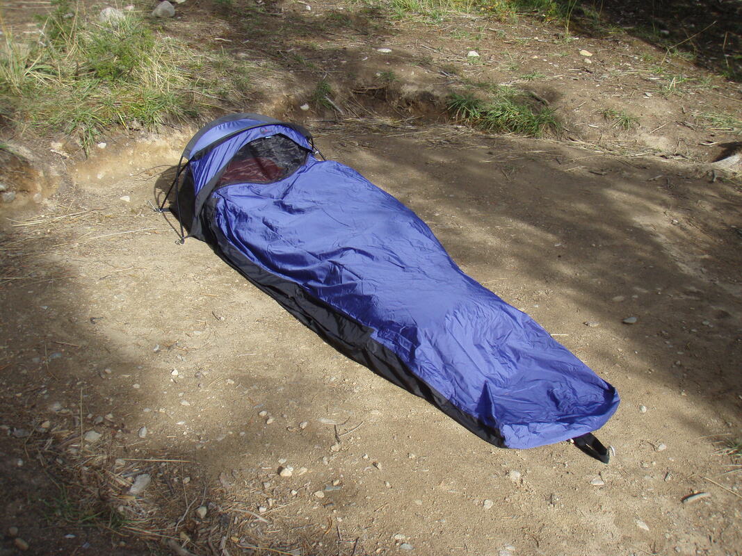 September 9 I woke up when my alarm went off at 06:00. It was still dark and the stars were still visible so I stayed in the sleeping bag until 07:45. when I finally got up it seemed quite cold. I made tea and oatmeal and had breakfast. Then I decided it was time to dry out my sleeping bag and the camp mattress. As I spread them out I was surprised to find that the top outside cover of the sleeping bag covered in a coating of frost. I thought I would wait until the sun rose above the mountain so that things would dry more effectively. I waited and waited and finally decided to pack everything away anyway. I packed the bed roll and sleeping bag and, last of all, the bivvy sack. Then, needless to say, at 10:45 the sun appeared over the mountain top. It was a welcome appearance. Why is it that you feel the cold so much more when you get older? I had been shivering from getting up until the sun was actually shining on me. 12:55 - stopped for lunch (?) break. One granola bar and a Gluco 5g. I took an unclearly marked trail but doubted my decision. As you ca see from the picture below, the trail was clearly marked but did not indicate that it was for the Athabasca Pass trail. I continued along the trail for some distance before I decided to go back to check out the other possibility which seemed to be the continuation of the fire road. However, a short way down the road it disappeared into a wet, swampy flood plain. 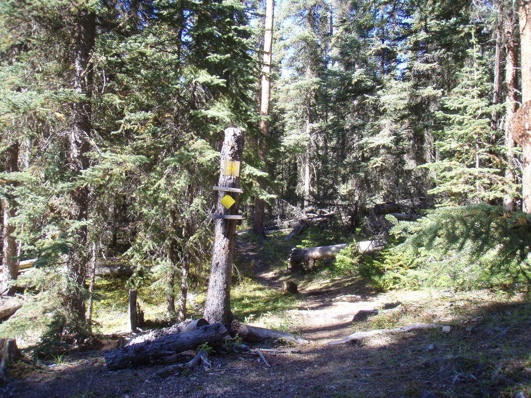 Walked and checked the other possibility and I was correct in the first place. Wasted 15 minutes time and energy. The trail I had to take had changed from a wide road to a narrow path with lots of roots and rocks. I'll take photos on my way back. I arrived at Tie Camp at 14:15. I was very surprised to see the campsite because I was expecting to walk for another hour. The map of this trail shows 6.0km from Whirlpool to Tie Camp but the sign here shows it was 4.0km. The map was correct and showed the correct distances but my memory was not so good and I managed to remember the distances in reverse. Perhaps another function of age? This is an old style campsite. There are two spots to pitch your tent, a fire box and a primitive pit toilet. 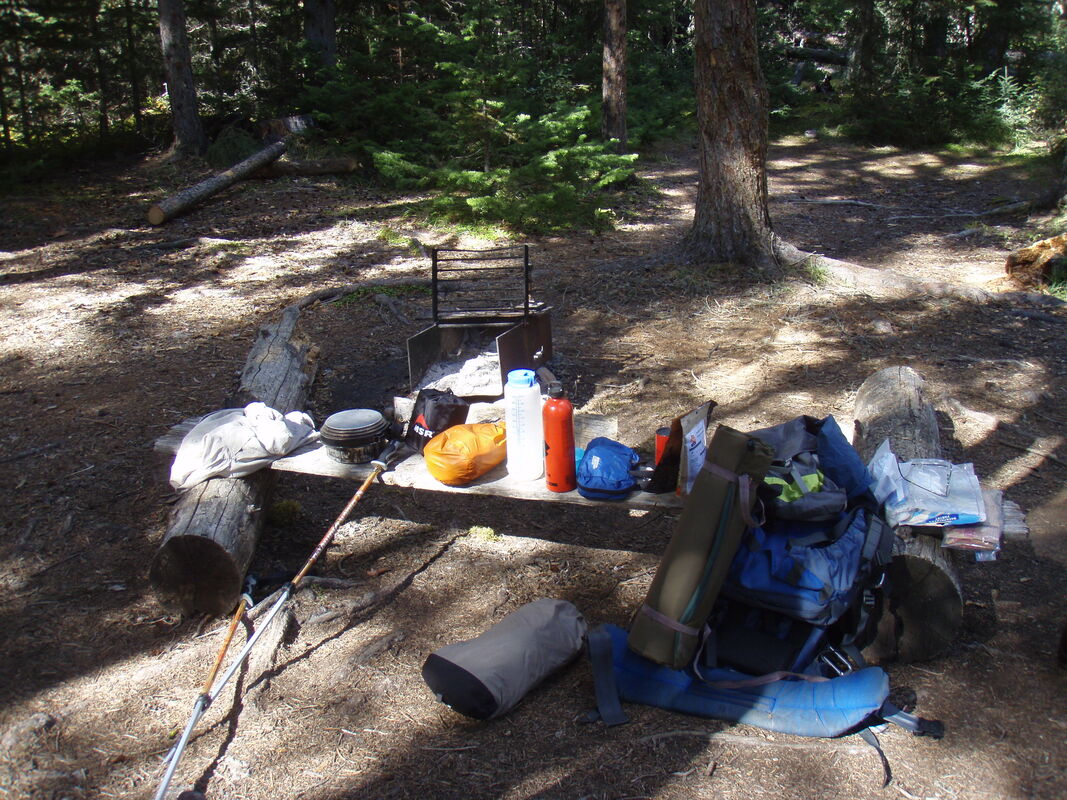 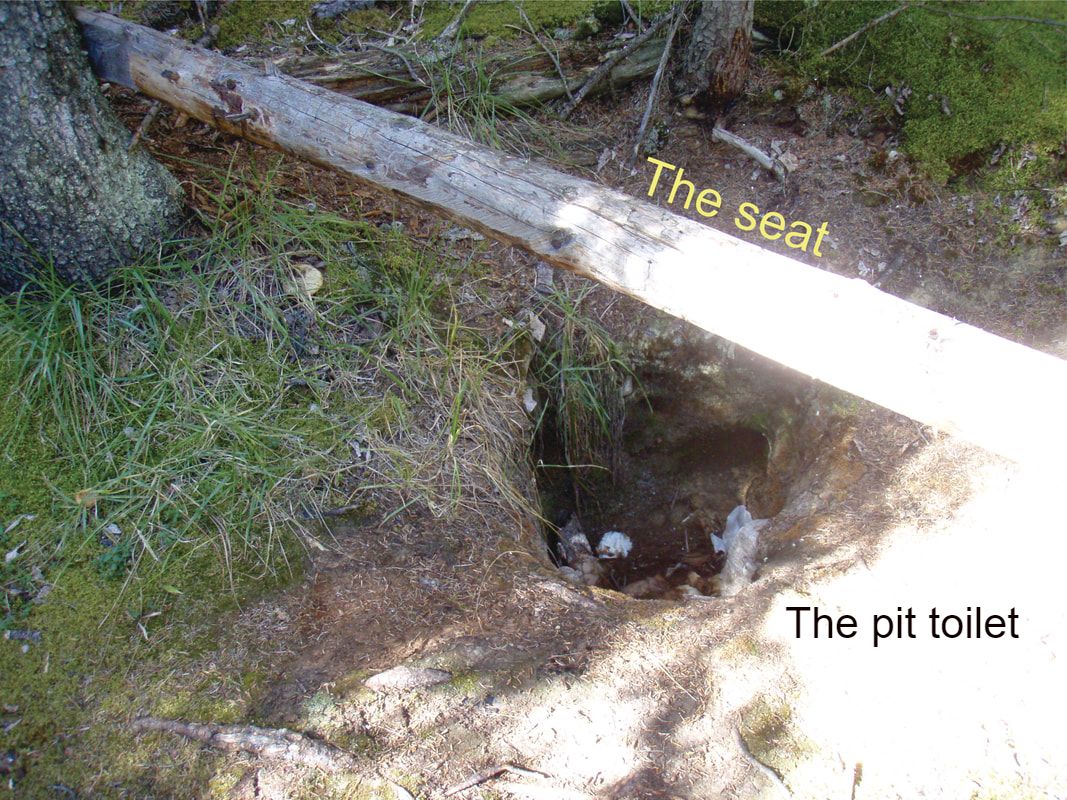 The method for removing food etc. from bears and other animals is a bear pole - a pole up high between two trees for you to hang up your food and equipment on a rope out of the reach of any animals. 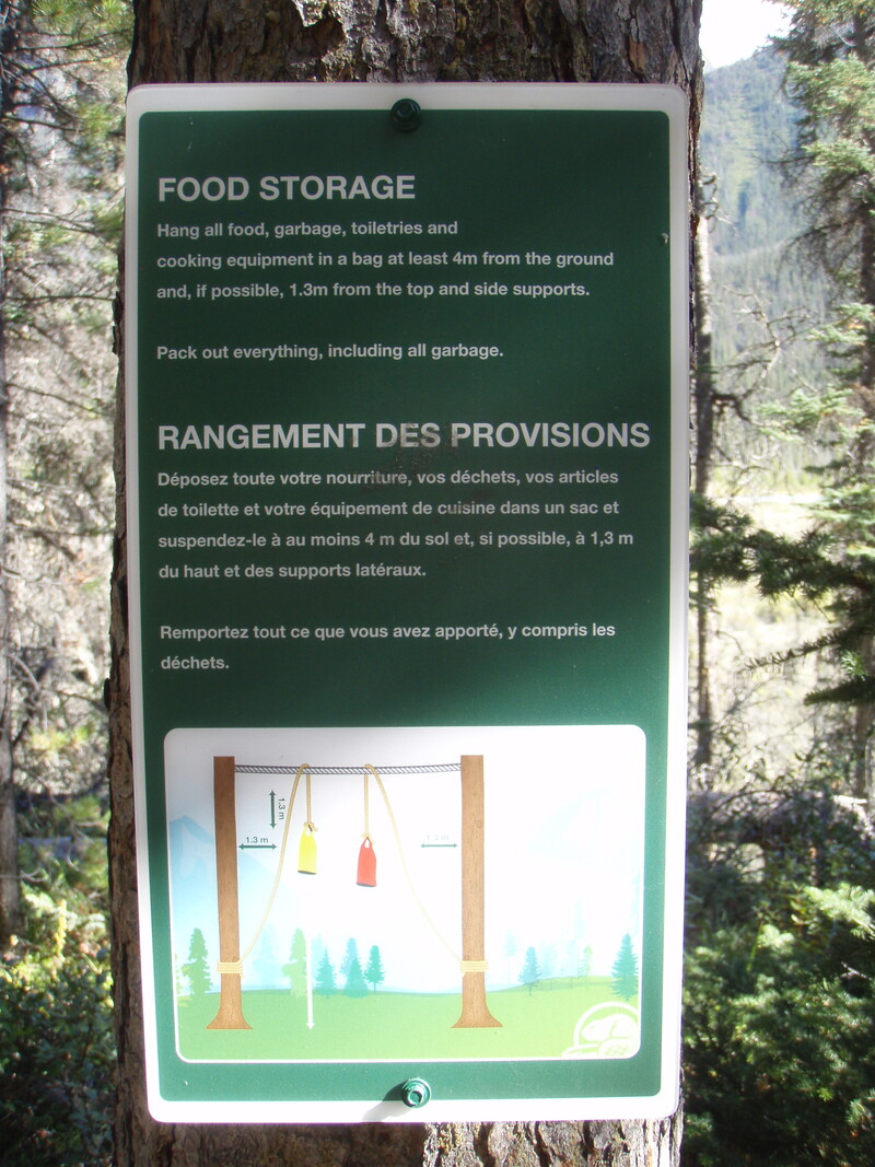 September 10 After packing up the camp I started to hike back out at 11:03. I arrived at the trail divide where the fire road starts at 11:57. I took a break for a granola bar and a drink of water. As promised, here is a picture of the narrow path that leads from the fire road to Tie Camp. 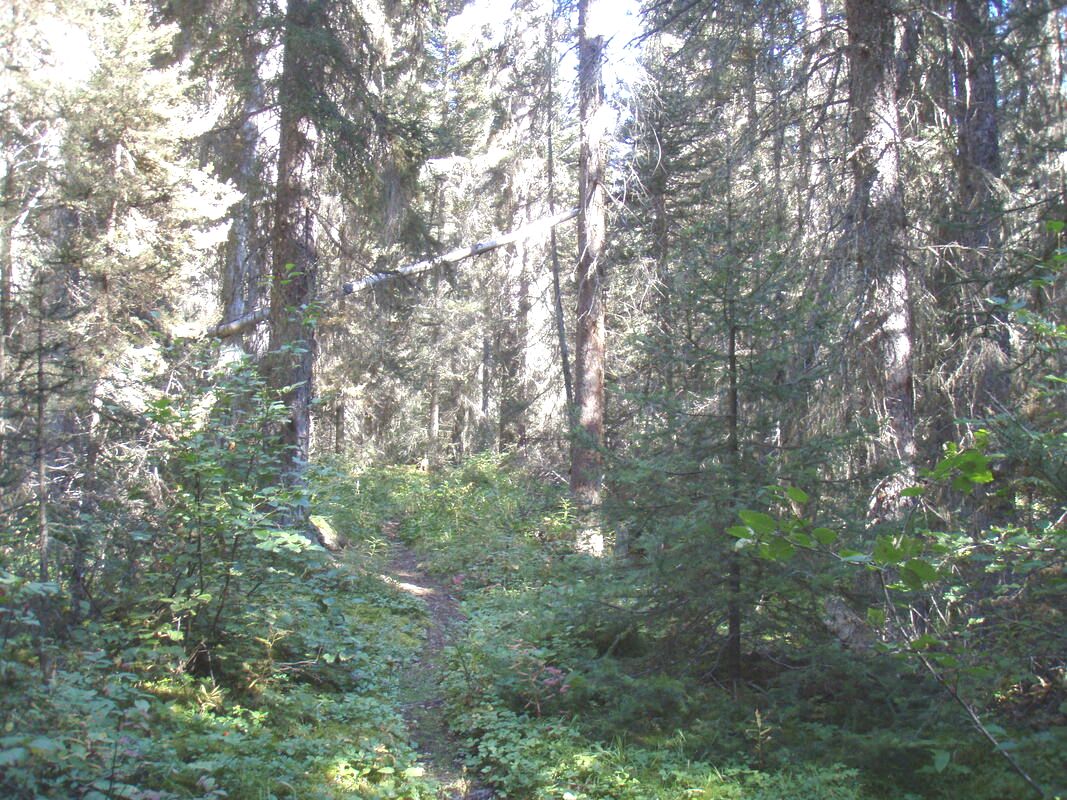 I started off again at 12:10 and arrived at Whirlpool campsite at 12:53. I sat at the table in the campsite and ate my usual lunch of two granola bars and a drink of water. I decided to walk out today instead of staying here for one more night. It was always an option to see if I could hike 10km with a full pack. Nothing much to report from here. Just my progress. I started off again at 13:30 and then stopped again for a break at 14:33 - the usual energy recharge; a granola bar and water. Started out again at 14:45. I wasn't sure how well I was progressing because I hadn't noticed the spot where I stopped last time I hiked this section of the trail. I started out again at 14:45 and continued until 15:35 when I stopped at the picnic table overlooking Moab Lake. Not far to go now. 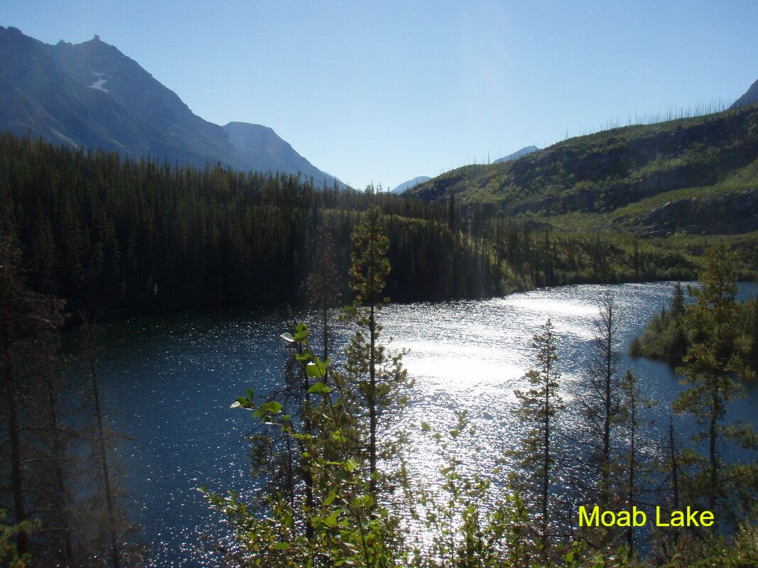 Off again at 15:42 and I arrived at the van in the parking lot at 15:57. The weather for the whole hike was sunny and warm in the daytime but decidedly cool at night. Normal conditions for September when you are in the mountains. The definite advantages to hiking at this time of year are the fall colours and the lack of mosquitos. Here are the statistics for this day's hike courtesy of the Sportractive app: Distance: 11.2km Walking: 3hours 45mins Total time: 4hours 54mins Breaks: 1hour 9mins 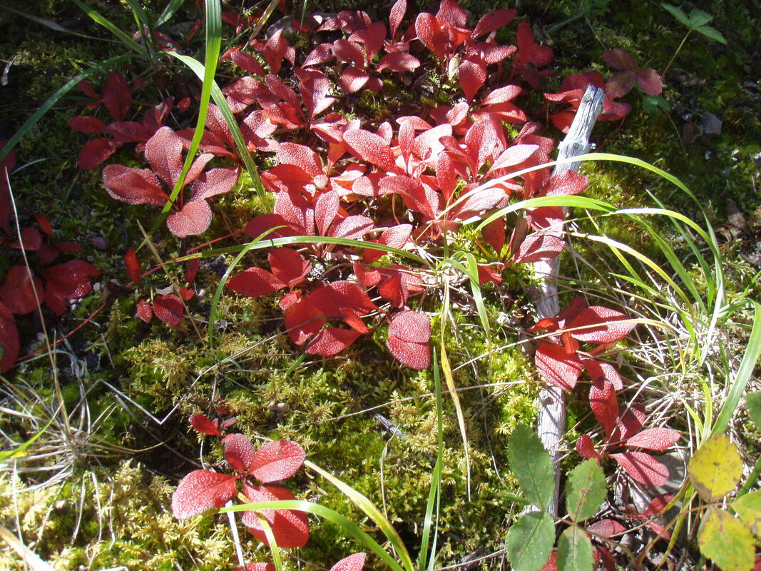
0 Comments
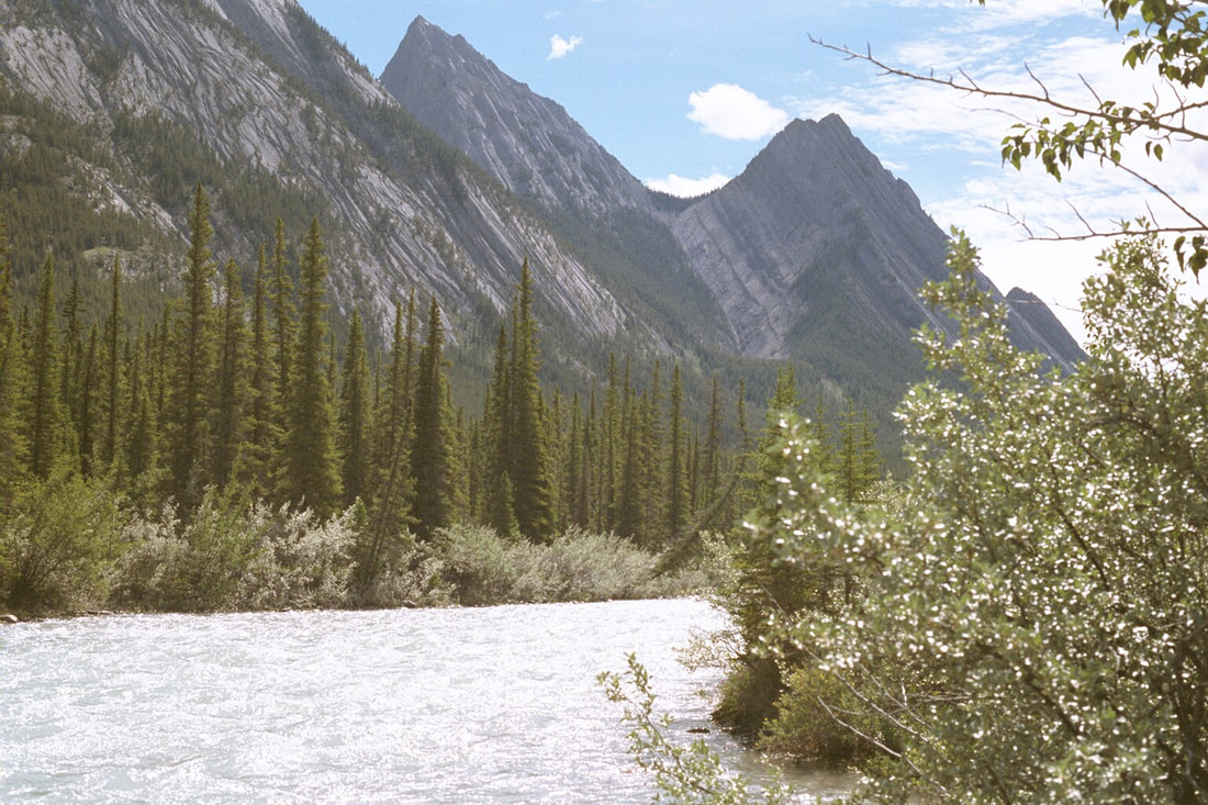
2020 is a year that we all would probably like to forget. The pandemic put most of our normal lives on hold and I was no exception. Looking back it seems that I slipped into a state of inertia and spent most of my time being "Busy doing nothing, working the whole day through trying to find lots of things not to do." As a result all my good intentions for completing another extended expedition turned into two minor back country camping trips along the first few kilometres of the Athabasca Pass trail. The trips themselves were enjoyable but were far from what I had either planned or considered for 2020. The trip to Tuscany had to be cancelled and the planning for a hike to the Athabasca Pass became a victim of my procrastination and an injury to my knee caused by our large dog pushing me down the creek bank at the end of Pyramid Lake. Athabasca Pass Trail, July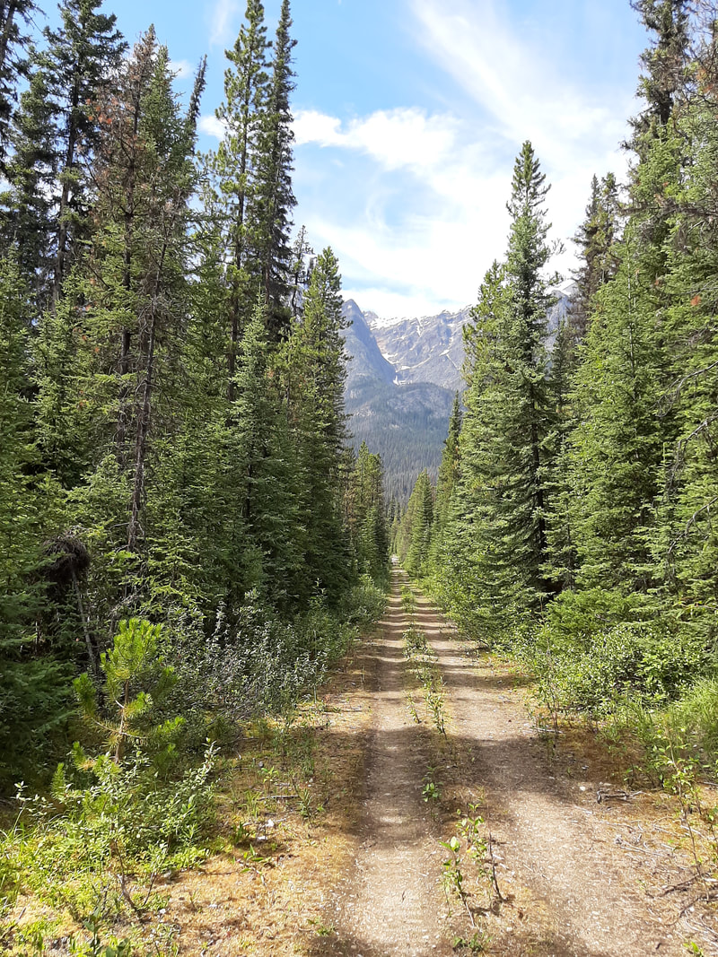 The goal for this hike was to walk to the first campsite on the trail, Whirlpool Campsite, camp for one night and then walk back out. It was also a test for my knee and to see how much I was capable of carrying as I still intended to walk to the pass at a later date in the year. The trail was easy going as for the most part it was level and followed an old road that was used first for hauling the lumber out to be used as railroad ties (sleepers) on the transcontinental railway that was being constructed and then later for access as a fire road. The weather was ideal - hot and sunny. I had no problems as I walked and the only things of notice were the beautiful views and a black bear crossing the trail about 300m in front of me. The bear emerged from the brush onto the trail, took one look in my direction and scuttled off in the opposite direction around a corner in the trail. Needless to say, I was very cautious as I approached and went round that corner but the bear was long gone. I arrived at the campsite around 3:30pm and set up camp. 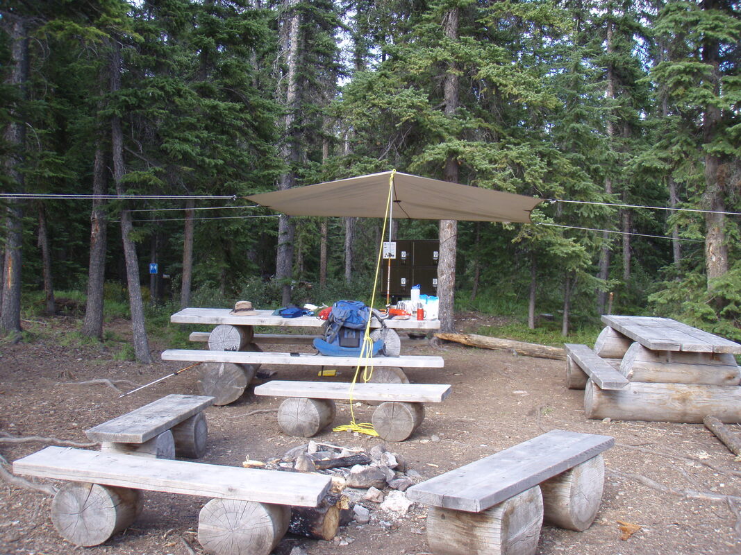 The campsite is pleasant, overlooking a lake with a view of the mountains. There are four tent pads, four food lockers and a pit toilet. It doesn't seem to be much used probably because it is too close to the trailhead at Moab Lake for the hikers that intend to reach Athabasca Pass. All campsites have there own version of the backcountry toilet and the trail crews have come up with interesting ways of protecting the campers' privacy. This campsite is a good example. At the start of the trail leading to the pit toilet there is a rope attached to a tree. If this rope is hanging down the tree trunk then the toilet is not occupied. If the rope is stretched across the trail then the toilet is in use.
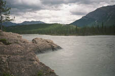
During the night as I lay in my sleeping bag inside my bivvy sack I heard two Cougars communicating on the mountain slopes above the campsite. Initially their calls were alarming - eerie, other worldly screams like an alien creature in great suffering. Once it was obvious what they were and that they were a safe distance from me their calls became part of the natural environment and an exciting wilderness experience. The walk back to Moab Lake was uneventful. The weather was hot and sunny and I made good progress. The only things of interest were fresh bear droppings on the trail and the view of Moab Lake close to the end of my two days of hiking. 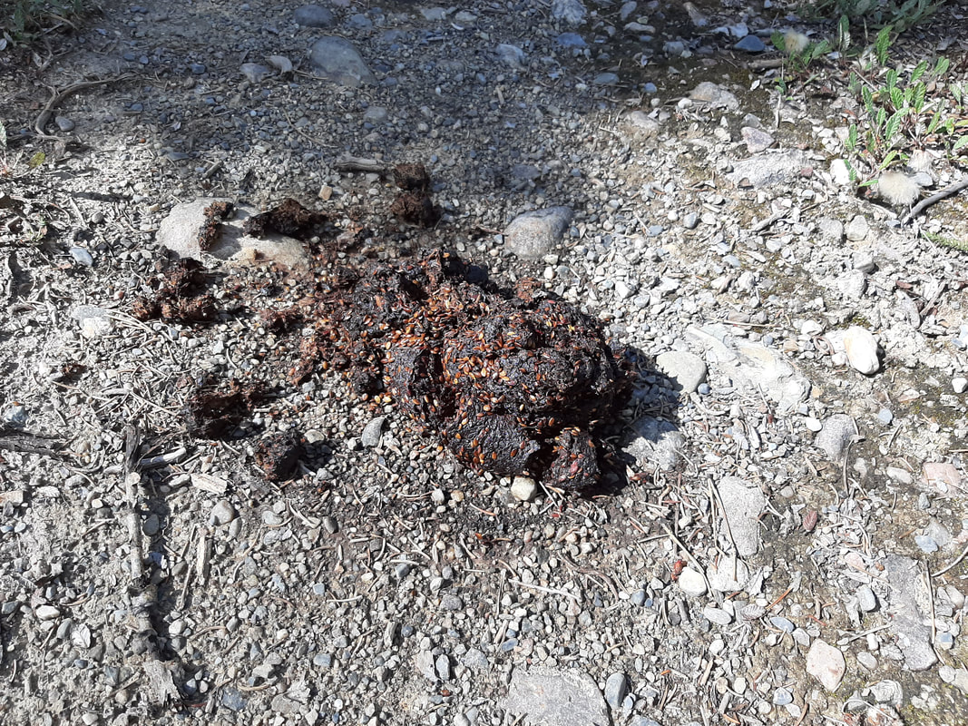 Notice the seeds in the dropping and then look at the picture below. The shrub is Common Bearberry also known as Kinnikinik. "The mealy berries are relished by bears and birds" (Wild Flowers of Alberta) 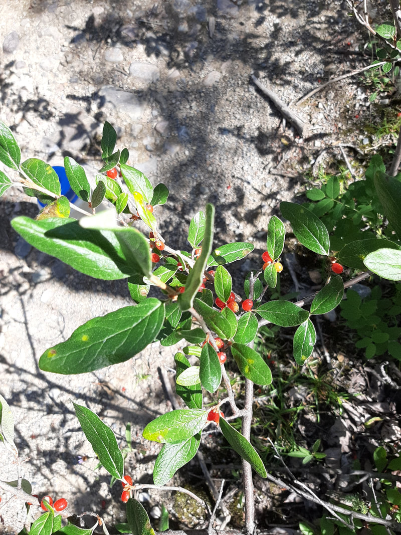 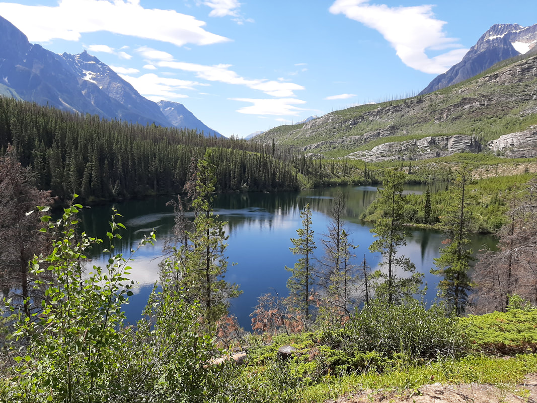 Looking west at the end of Moab Lake Looking west at the end of Moab Lake
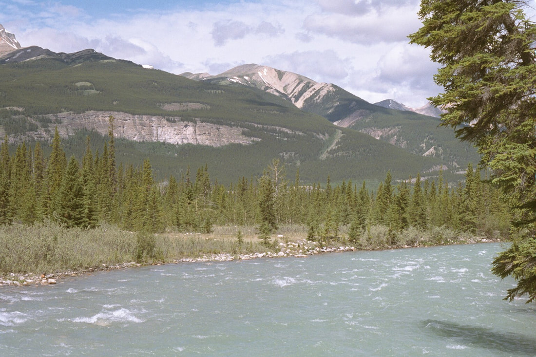
There are two rivers that are of interest to me for this year's extended trip - the North Saskatchewan River and the Athabasca River. Both have historical importance for Canadian history, both for the opening of the west by David Thompson and the latter for the amazing explorations of Canada by Alexander MacKenzie. Both rivers offer wilderness travel for long distances and for extended periods of time. From Edmonton to Cumberland House on the North Saskatchewan is a journey of 600 miles and from its source in Jasper National Park to Lake Athabasca along the Athabasca River is a journey of 765 miles. I have pictures of the North Saskatchewan River from my many paddles on the river from Saskatchewan River Crossing to Edmonton but I don't have any of the Athabasca River.
I would love to paddle both of these routes and follow in the footsteps of the early fur trade explorers especially the North Saskatchewan because I hold a great admiration for David Thompson. Unfortunately travelling solo down the Athabasca River would be impossible for me because of the difficulties created by rapids and the logistical nightmare of resupplying food and fuel along the way. The North Saskatchewan is still a possibility but it is too late to consider it for this year. There are enough communities along the river that it would be possible to stop and buy supplies along the way. However there is a problem at the end of the trip. What do I do with the canoe and all of my equipment? Cumberland House is a small, isolated community difficult to access by road and 1229 kilometres from Jasper. For that matter, how do I get back to Jasper even if I abandon all of my equipment by leaving it as a gift for the local Cumberland House residents? If I am going to attempt this journey I will need a paddling partner and a person who is willing to meet us at the end of the trip to load up the canoe and equipment and return to Jasper. Maybe next year. We'll see.
Obviously paddling is not an option for this year. The first decision I have to make is whether I should do an extended canoe trip or should I do a multi-day hike. Both have their advantages and disadvantages so let's explore what they are.
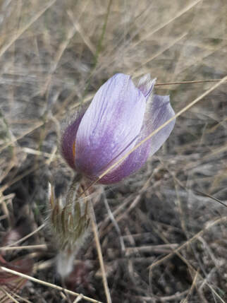
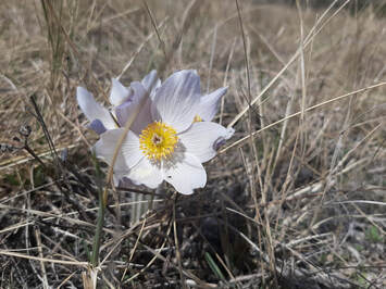
Paddle The first obvious advantage to doing a trip in a canoe is that both of my canoes are capable of carrying 408kg (900lb) and that weight is not on my back. On an extended trip I can carry enough supplies and equipment to last for a lot of days before I have to resupply. I can also carry all the gear I could need for my comfort and safety in all anticipated circumstances. Its nice to have a cast iron griddle with you when you want to have eggs and pancakes for breakfast. Next is the fact that both of my canoes are equipped with spray decks which means everything inside is weather tight including me if I'm wearing a rain jacket. Nice and dry as long as you don't have to get out of the canoe. Travelling long distances down a river in a canoe is made easier by the fact that the river has a current that helps you on your way. On the upper reaches of the North Saskatchewan River the river current is significant and I have recorded speeds of 12kph on my GPS with the river current and my paddling effort. So travel days of 80km or more are quite realistic. Unfortunately lakes are not so helpful but they offer a slower pace and more opportunities for appreciating the scenery and taking photographs. Travelling down a river provides the opportunity to stop in towns along the way to buy groceries and other provisions even when the route is through quite remote areas. Unlike in England where I was able to have lunch at a food stall at a lock, in a riverside restaurant or a local pub, on most Canadian rivers cities, towns and villages are few and far between but they do exist. Which relates back to my first paragraph, I can carry enough to get me to the next point of civilization. The disadvantage to doing a long canoe trip is that you have to have somebody take you to the starting point and then pick you up at the end of your trip. For an extended trip the start is a minor inconvenience but the pick up at the end could mean hundreds of kilometres and several days of travel. If I were to paddle down the Athabasca River from Jasper to Whitecourt it would mean a round trip of 524km and an overnight stay in Whitecourt. At the present time, unless I stay within Alberta, I would be crossing into Saskatchewan and possibly Manitoba and both provinces have placed restrictions on cross border travel. British Columbia has closed all of their parks to visitors from out of province so the lakes that I was considering are not available. If I were to travel down one of the rivers I'm not sure what my welcome would be if I arrived in town and walked to the grocery store. Another disadvantage to a river trip is the limited view that you have once you are out of the mountains. Down in between the river banks all you can really see is the vegetation growing along the banks - not very interesting or exciting. You are also controlling the canoe so you have to pay attention to the route ahead so that some hazard doesn't cause an unexpected capsize. Walk When it comes to long distance walks in Jasper National Park the number of choices are numerous. Most are clearly defined by well maintained trails although the Jasper Park administration has stopped maintaining many of them in recent years. The available walks are among some of the most spectacular hiking trails in the world surrounded by mountains and rushing rivers. Some routes were the working trails used by the park wardens to patrol the backcountry (North & South Boundary trails), others were developed to access beautiful wilderness areas (Skyline Trail, Tonquin Valley Trail, Fryatt Valley Trail) and still others were trails used by the early Europeans who travelled, explored and exploited the mountain areas (Athabasca Pass Trail, Overlander Trail). The advantages to these trails are many. As you walk along at whatever is your chosen pace you are surrounded by hugely varied aspects of natural beauty. Mountains, rivers, wild flowers, animals in their natural environments and many different kinds of birds are all around you as you travel along. Seemingly the best choice for my expedition this year, but..... On an extended wilderness hike I would have to carry sufficient food, equipment and safety gear to last for the duration of the trip. That alone is a big disadvantage but that isn't all. With the restrictions on the equipment that I can carry due to weight and space it is difficult to ensure my comfort in inclement weather. Several rainy days would mean everything would be wet and I would be miserable. There is also the possibility of encounters with unfriendly wildlife. The one that everybody thinks of is running into a bear, but other less frightening creatures can also cause problems. If you leave any equipment accessible to the animals you can find that it has been chewed by small animals like rodents and porcupines. There also the issue of water. Are there enough sources of water along the route? When you plan a trip it is important to take into consideration the availability of water along the route because that will affect the amount you have to carry. On top of all of this, Parks Canada has not opened up access to the backcountry trails at the moment and they have not given a clear indication as to when they will start to take reservations. There's so much to think about before I make my decision for this year's trip and it's further complicated by the pandemic restrictions. So let's look at the possibilities in the next and subsequent posts. 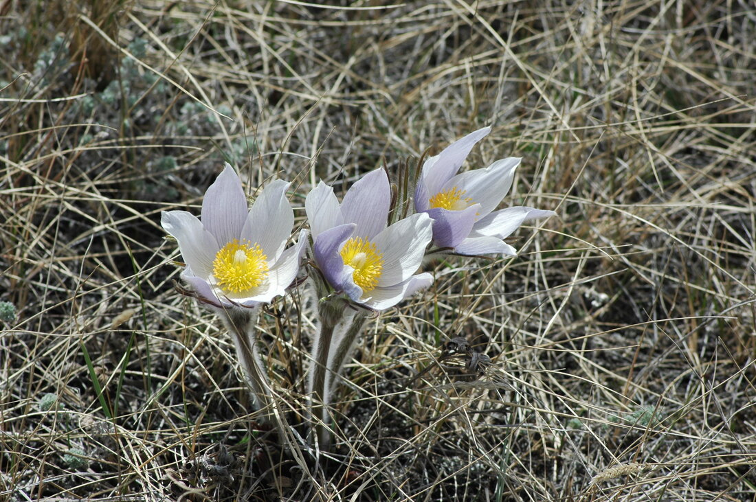 Here in Jasper the Prairie Crocus is the first sign that spring has truly arrived. They make their appearance among the wild fescue grass on the airfield shortly after the snow has gone and the soil is moistened by a spring rain shower. This year they are a sign that I have to consider my options for my outdoor trip in memory of Eva, Hazel and Lily, my three granddaughters that we lost as babies. My original plan was to travel to Italy with my brother where we were going to walk from the north to the south of Tuscany along the Via Francigena. All of my travel plans were organized and booked before the end of December and before Covid-19 became an issue. So now - what to do? At the moment we have no idea what the airlines are going to do about international flights at the end of August and what they intend to do about refunds for passengers that want to cancel their reservations. All I can do is come up with a contingency plan to put into effect if it is inadvisable for two old guys like my brother and me to travel to the UK and Italy before the pandemic is completely under control and transmission is effectively zero. This blog will share my thoughts on the alternative travels that I am considering with the pros and cons of each and the plans that would be necessary for each. I'll try to make it as interesting as possible with maps and pictures of each possibility.
It's important to remember what Hazel's Heroes and Hazel's Helper are all about. Many of you who have followed this blog from the beginning will know why I embark on these extended adventures but I will explain again for those who have recently started to follow my posts.
After my infant granddaughter, Hazel, died suddenly in her sleep her parents, Gill and Gareth, had to struggle through the trauma and grief caused by her death with no one who really understood. After suffering through a dark period and experiencing the lack of easily accessible and meaningful support that she needed, Gill decided to do something about it. She created Hazel's Heroes, an organisation to provide support to mothers who have lost an infant child and to raise awareness about SIDS (Sudden Infant Death Sydrome) and SUID (Sudden Unexpected Infant Death). She became active in SIDS Calgary (https://sidscalgary.ca) an organisation that is "committed to providing support to families, representing the interests of parents, educating healthcare professionals as well as the public, and raising funds for SIDS research." Gill also wanted to provide the support that she found lacking after Hazel died so she made it her goal to establish a retreat for mothers so that they could spend some time with others who shared a similar loss. With her focus and energy she has been able to fund and organize three successful retreats at a beautiful Kananaskis mountain resort. |
Hazel's PoppaI'm a grandfather who lost an infant granddaughter and who wants to help Gillian, her mother, provide support for other grieving parents through Hazel's Heroes. Archives
February 2021
Categories |
 RSS Feed